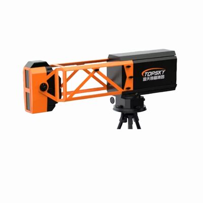
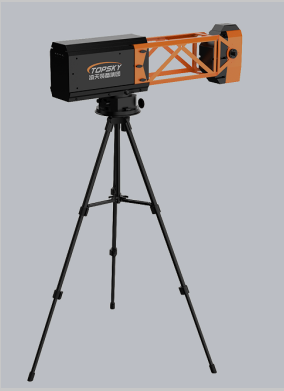
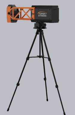
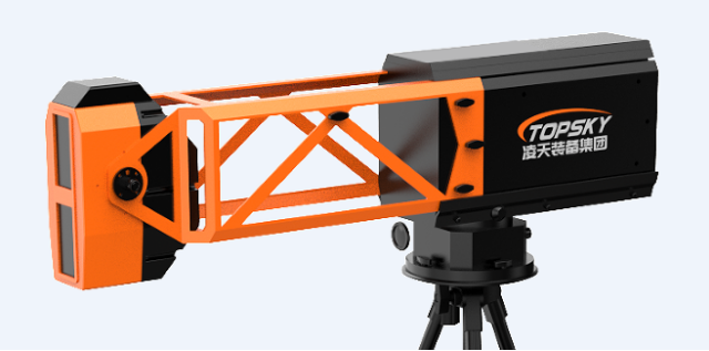
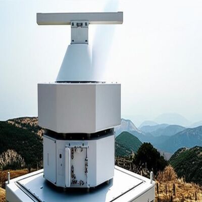
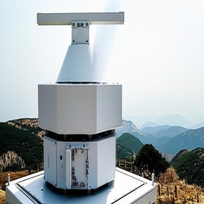
logo
Μας ελάτε σε επαφή με

Υπεύθυνος : Yang

Τηλεφωνικό νούμερο : +8618010030825

WhatsApp : +8613436381865

Free call

Panoramic Slope Monitoring Radar with 360° Coverage, 0.1mm Accuracy, and 8kg Portable Design for Emergency Rescue

Τόπος καταγωγής: Κίνα Μάρκα: TOPSKY

Λεπτομερής ενημέρωση

Πακέτο: 1pc/τσάντα Υψόμετρο διέλευσης εμποδίου: 300 χιλ.,
Μοτέρ: 12V Θερμοκρασία αποθήκευσης: -45°C ∼65°C·
Όνομα προϊόντος: Αντιτρομοκρατικός εξοπλισμός Σωματικό βάρος: 16 κιλά
Μέγεθος μονάδων ελέγχου: όχι μεγαλύτερο από 263x206x156mm Μέγεθος τρυπανιών: 4/5/6/8mm
Διάμετρο διακοπής: 60-140 εκατοστά Αγκιστρο: SML
Υλικό πάνελ: Ύφασμα UD αραμιδίου (Kevlar) Μέγεθος Beacher: 73*16*50cm
Μορφή εικόνας: JPEG ή BMP Τραβήξτε κλειδαριές: 15
Επίπεδο προστασίας: NIJ IIIA για 9mm και .44mag
Επισημαίνω:

360° Coverage Slope Monitoring Radar

,

0.1mm Accuracy Panoramic Radar

,

8kg Portable Emergency Radar

Περιγραφή προϊόντων

Panoramic Slope Monitoring Radar
The PSR-5000J emergency ultra-portable slope monitoring radar utilizes circular arc synthetic aperture radar technology with broadband frequency modulation continuous wave signals and phase difference interferometry measurement. This advanced system provides comprehensive 360° coverage, precise deformation measurement, and reliable all-weather operation.
Designed specifically for emergency rescue operations, this equipment emphasizes lightweight construction, portability, and low power consumption. With industry-leading size, weight, and power efficiency metrics, it enables rapid deployment in critical situations.
Key Applications
  • Open pit mines and geological landslides/collapses
  • Emergency rescue operations and disaster response
  • Water conservancy dams and infrastructure monitoring
  • Urban subsidence and subway transportation systems
  • Large bridges, high-rise buildings, and wind turbine towers
  • Railway slopes and transportation corridors
Technical Features
  • Precision Measurement: 0.1mm deformation accuracy with 30-second data update rate
  • All-Weather Operation: Microwave penetration capability ensures 24/7 monitoring unaffected by rain, snow, fog, or smoke
  • Complete Coverage: 360° panoramic monitoring without distance or angle blind spots
  • Edge Computing Architecture: Integrated processing, positioning, and communication functions within compact 8kg body
  • Rapid Deployment: Folded dimensions of 0.5×0.3×0.25m fit in 24-inch transport case for airline consignment
  • Remote Control: Electric pitch angle adjustment for flexible monitoring of varied terrain
  • Network Connectivity: B/S architecture supports local WiFi and remote 4G/5G cloud monitoring
  • Advanced Algorithms: Adaptive atmospheric disturbance compensation with less than 2mm/day error
  • Smart Alert System: Four-level sound/light, SMS, and email alarms with manual/auto monitoring points
  • 3D Visualization: Fast-rendering terrain matching algorithm with sub-meter accuracy
  • Rugged Design: IP66 protection rating and operational capability down to -40°C
Portability & Deployment
Weighing only 8kg with compact folded dimensions, the system enables single-person transport and rapid setup. The integrated edge computing architecture eliminates external processing requirements, allowing immediate operational readiness at emergency sites to protect rescue personnel from secondary disaster threats.

Μπορεί να είσαι σε αυτά
Ελάτε σε επαφή μαζί μας

Εισάγετε το μήνυμά σας

sale5.ex@topskytech.com
+8613859950250
13311564366
13311564366